
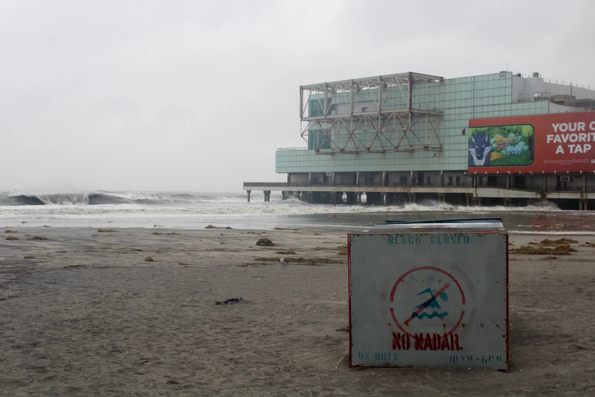
A powerful, slow-moving coastal system hammered the greater Philadelphia area, South Jersey, and Delaware over the weekend, causing widespread coastal flooding, beach erosion, and severe transit delays. The East Coast nor’easter severe weather prompt state officials to enact regional emergency declarations as rising tide levels and gusty winds swept inland from coastal barrier islands.
Impacts from the storm began manifesting on Friday, September 25, before worsening significantly on Saturday, September 26. Emergency management agencies across multiple states remain on high alert as the system continues to track across the Mid-Atlantic coastline, threatening low-lying communities with major water inundation and prolonged power outages.
State Emergency Declarations and Regional Weather Forecast
In response to the deteriorating weather conditions, New Jersey Governor Mikie Sherrill issued a state of emergency effective 5 p.m. Friday for eight key counties: Atlantic, Burlington, Cape May, Cumberland, Middlesex, Monmouth, Ocean, and Salem. The activation of the State Emergency Operations Center has streamlined real-time communications between municipal response crews and state first responders.
According to forecasts from the National Weather Service office in Mt. Holly, New Jersey, the slow-moving system is anticipated to maintain its influence on the region through Sunday. Meteorologists project the center of the storm to make landfall early Sunday morning between Long Beach Island and Sandy Hook, New Jersey, bringing heavier bands of rain following Saturday’s lighter precipitation.
Weather advisories and warnings highlight several severe hazards across the region:
- Major Coastal Flooding: Coastal flood warnings remain active until 2 a.m. Sunday for Atlantic and Cape May counties in New Jersey, along with Kent and Sussex counties in Delaware. Wave heights along the oceanfront could reach up to 12 feet.
- High Wind Warnings: Coastal zones in Delaware and New Jersey face high wind warnings through 6 a.m. Sunday, with wind gusts reaching up to 60 mph. Inland communities remain under broader wind advisories.
- Power Grid Vulnerabilities: Utility companies are bracing for widespread power outages driven by saturated soils, downed trees, and intense wind pressure.
Widespread Road Closures and Transit Disruptions
Transportation networks across New Jersey and Delaware experienced substantial disruptions due to standing water and hazardous conditions. State transit agencies and departments of transportation have issued continuous travel warnings, advising motorists to avoid flooded corridors and respect established detours.
Key road closures reported by regional authorities include:
- New Jersey Ocean County: Route 72 in Ship Bottom was closed in both directions at Shore Avenue. In some shore communities, rising waters prompted voluntary foot evacuations on Friday.
- Cape May County: Route 47 in Lower Township faced full closure across all lanes near Route 624 and West Rio Grande Avenue.
- Atlantic & Monmouth Counties: Route 52 southbound at Route 585 in Somers Point was shut down, while Route 36 in Sea Bright at Highlands Bridge and Shrewsbury River Bridge was blocked in both directions.
- Burlington County: Downed trees and power lines forced the complete closure of Route 57 west of Stephensburg Road in Mansfield Township.
- Delaware Coastal Routes: Delaware Department of Transportation closed Route 1 entirely between Bethany Beach and Dewey Beach due to severe ocean overwash and street flooding.
Public transportation systems have similarly adjusted services to manage safety risks along affected routes:
- Amtrak: Selected Northeast Corridor train services connecting Harrisburg, Philadelphia, and Boston faced cancellations and schedule modifications.
- NJ Transit: Service on the River Line Light Rail was suspended between Cass Street and Florence stations, with substitute busing deployed for commuters.
- PATCO: Speed restrictions and modified operating schedules remain active through Monday.
- Aviation Delays: Flight operations at Philadelphia International Airport (PHL), Newark Liberty International Airport (EWR), and Lehigh Valley International Airport (ABE) reported delays and potential cancellations, with passengers advised to verify flight status directly with carriers.
Impact on Local Communities and Event Cancellations
The severity of the coastal storm forced event organizers across the Philadelphia region to alter major weekend plans. High-profile outdoor activities—including the South Street Fall Fest—were canceled outright. Meanwhile, the 31st Chinatown Mid-Autumn Festival and scheduled Philadelphia Half Marathon training runs were officially postponed to later dates.
Along the Atlantic City boardwalk, beaches were closed to the public as crashing surf covered the shoreline. Despite the driving rain and hazardous street flooding, some visitors celebrating major personal milestones observed the powerful ocean waves from safe distances. Concurrently, local essential workers battled flooded intersections across coastal cities, navigating waterlogged roadways to maintain public utilities and service facilities.
As the slow-moving storm system gradually moves inland through Sunday morning, public safety officials continue to emphasize caution. Residents in coastal and flood-prone zones are strongly encouraged to secure outdoor gear, avoid driving through waterlogged roadways, and stay updated through regional emergency management broadcasts.